water-routefinder
Downloads met-ocean data (currents, waves, wind), harmonises it onto one grid, and samples it onto
vessel-route geometry — producing the environmental-conditions bundle
water-path consumes. A
Snakemake workflow, managed with pixi.
resources/user/{network}/{routes.geojson,harbours.csv}   <- your input
        |
   make_bbox -> download (cmems|era5, per family) -> harmonise -> sample -> bundle -> validate -> diagnostics
        |
results/{network}/{network,environment,validation.txt,{network}_diag_plot.png}
What it produces
For every network you point it at, water-routefinder writes:
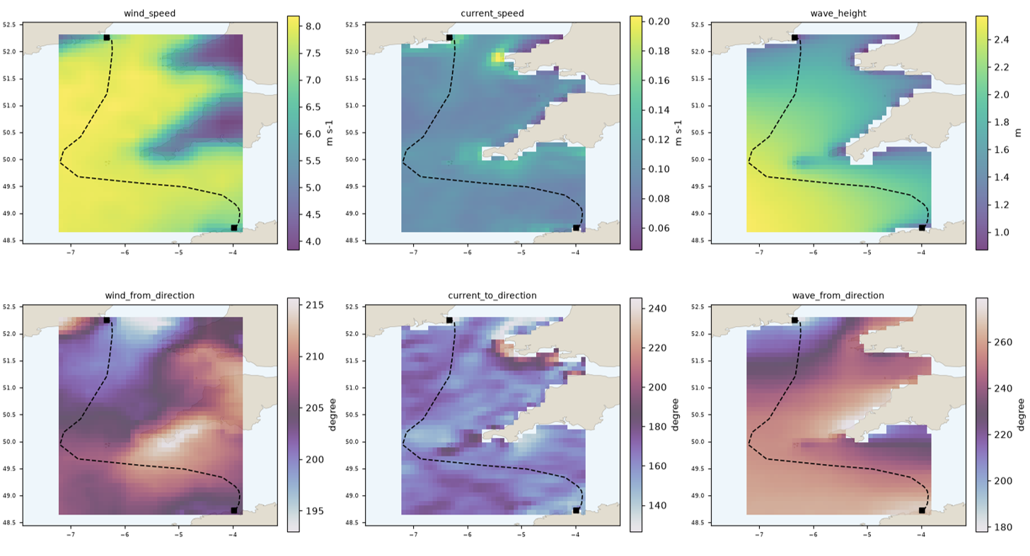
network/{harbours.csv,routes.geojson}andenvironment/{conditions.parquet,conditions.meta.yaml}— the v0.2 bundlewater-pathreads.validation.txt—OK, or every contract violation found.{network}_diag_plot.png— a route map (real coastlines, rendered fully offline), per-variable conditions over time, and a data-quality summary.{network}_availability_map.png— one map per variable (wind, current, wave × speed/direction) of the source grid's own coverage, with the route overlaid, so a route crossing a gap in the data is directly visible.
Where to go next
- Quickstart — install, run the example, build your own network.
- Configuration — every
config/config.yamlkey, and how to authenticate with Copernicus Marine / the Climate Data Store. - Architecture — how the pieces fit together, and the design conventions.
- Bundle contract (v0.2) — the exact file format this repo produces.
- Roadmap — design history and what's not built yet.
Source on GitHub: FraSanvit/water-routefinder.